


Regional Planning Commission 7--New Orleans City (Central) PUMA, Louisiana
About
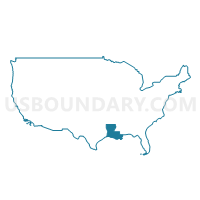
Outline
+PUMA%2c+Louisiana_A280.png)
Summary
| Unique Area Identifier | 193018 |
| Name | Regional Planning Commission 7--New Orleans City (Central) PUMA |
| State | Louisiana |
| Area (square miles) | 16.93 |
| Land Area (square miles) | 16.62 |
| Water Area (square miles) | 0.31 |
| % of Land Area | 98.18 |
| % of Water Area | 1.82 |
| Latitude of the Internal Point | 29.96804980 |
| Longtitude of the Internal Point | -90.08045180 |
Maps
+PUMA in Louisiana.png)
Graphs
Select a template below for downloading or customizing gragh for Regional Planning Commission 7--New Orleans City (Central) PUMA, Louisiana
+PUMA%2c+Louisiana_T0.png)
+PUMA%2c+Louisiana_T1.png)
+PUMA%2c+Louisiana_T2.png)
+PUMA%2c+Louisiana_T3.png)
+PUMA%2c+Louisiana_T4.png)
+PUMA%2c+Louisiana_T5.png)
+PUMA%2c+Louisiana_T6.png)
+PUMA%2c+Louisiana_T7.png)
+PUMA%2c+Louisiana.png)
Neighbors
Neighoring Public Use Microdata Area (by Name) Neighboring Public Use Microdata Area on the Map
- Regional Planning Commission 3--Jefferson Parish (North) PUMA, LA
- Regional Planning Commission 4--Jefferson Parish (Central) PUMA, LA
- Regional Planning Commission 5--Jefferson Parish (West Bank) PUMA, LA
- Regional Planning Commission 6--New Orleans City (Northeast) PUMA, LA
- Regional Planning Commission 8--New Orleans City (South) PUMA, LA
Top 10 Neighboring County (by Population) Neighboring County on the Map
Top 10 Neighboring County Subdivision (by Population) Neighboring County Subdivision on the Map
- New Orleans city, Orleans Parish, LA (343,829)
- District 5, Jefferson Parish, LA (91,268)
- District 2, Jefferson Parish, LA (81,272)
Top 10 Neighboring Place (by Population) Neighboring Place on the Map
- New Orleans city, LA (343,829)
- Metairie CDP, LA (138,481)
- Jefferson CDP, LA (11,193)
- Bridge City CDP, LA (7,706)
Top 10 Neighboring Unified School District (by Population) Neighboring Unified School District on the Map
Top 10 Neighboring State Legislative District Lower Chamber (by Population) Neighboring State Legislative District Lower Chamber on the Map
- State House District 81, LA (42,777)
- State House District 82, LA (39,989)
- State House District 83, LA (38,305)
- State House District 95, LA (34,279)
- State House District 94, LA (31,652)
- State House District 93, LA (30,550)
- State House District 98, LA (30,348)
- State House District 91, LA (30,143)
- State House District 97, LA (25,853)
- State House District 101, LA (25,026)
Top 10 Neighboring State Legislative District Upper Chamber (by Population) Neighboring State Legislative District Upper Chamber on the Map
- State Senate District 6, LA (137,299)
- State Senate District 8, LA (113,097)
- State Senate District 5, LA (82,088)
- State Senate District 3, LA (79,418)
- State Senate District 4, LA (71,484)
- State Senate District 2, LA (65,868)
Top 10 Neighboring 111th Congressional District (by Population) Neighboring 111th Congressional District on the Map
Top 10 Neighboring Census Tract (by Population) Neighboring Census Tract on the Map
- Census Tract 282, Jefferson Parish, LA (4,505)
- Census Tract 37.02, Orleans Parish, LA (3,470)
- Census Tract 17.20, Orleans Parish, LA (3,410)
- Census Tract 248, Jefferson Parish, LA (3,336)
- Census Tract 33.08, Orleans Parish, LA (3,186)
- Census Tract 145, Orleans Parish, LA (3,059)
- Census Tract 99, Orleans Parish, LA (2,998)
- Census Tract 117, Orleans Parish, LA (2,924)
- Census Tract 121.01, Orleans Parish, LA (2,855)
- Census Tract 24.02, Orleans Parish, LA (2,849)
Top 10 Neighboring 5-Digit ZIP Code Tabulation Area (by Population) Neighboring 5-Digit ZIP Code Tabulation Area on the Map
- 70001, LA (37,996)
- 70119, LA (36,228)
- 70118, LA (33,008)
- 70115, LA (31,695)
- 70094, LA (31,669)
- 70122, LA (28,564)
- 70005, LA (24,339)
- 70126, LA (23,958)
- 70117, LA (23,389)
- 70124, LA (16,824)